 Maps
Maps
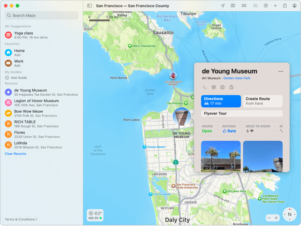
Get directions and view locations using a map or a satellite image. Get recommendations for the best places to visit in a city, with guides curated by Apple.
Explore in detail. Maps shows more details to help you discover what’s out there, including landmarks, elevation, natural features, and more. On your iMac, new city experiences offer details like landmarks, buildings, and even trees.
Plan your route. Use the driving map to plan your route, check for traffic, and see road details, like turn and bus lanes. Plan routes with multiple stops and automatically view them on your iPhone or quickly share directions with a friend via Messages.
Find and save your favorites. Find what you’re looking for and filter the results. Click on a place to learn important information, like opening hours for a business or whether a restaurant offers takeout. You can save the places you go most often to your favorites.

Siri: Say something like: “Find coffee near me.”
Discover new places with guides. To help you discover great places around the world to eat, shop, and explore, Maps offers curated guides from trusted brands and partners. You can save these guides and get updates whenever new places are added.
Create your own guides. You can create your own guides for your favorite places and share them with friends and family. To create a guide, move the pointer over My Guides in the sidebar, click ![]() on the right, then Control-click the new guide to see a menu of options.
on the right, then Control-click the new guide to see a menu of options.
Explore in 3D. Click Look Around ![]() to explore select cities in 3D as you move smoothly through the streets in an interactive experience. On your iMac, you can use the interactive 3D Globe to experience the Earth’s natural beauty.
to explore select cities in 3D as you move smoothly through the streets in an interactive experience. On your iMac, you can use the interactive 3D Globe to experience the Earth’s natural beauty.
See indoor maps for major destinations. Find your way around select airports and shopping malls. Just zoom in to see what restaurants are near your gate, find a restroom, plan a spot to meet up with friends at the mall, and more.

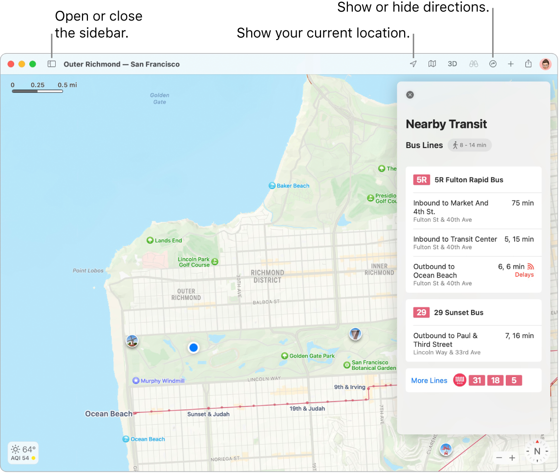
Get there on public transit. Maps provides Nearby Transit information for select cities, including upcoming departures near you. Click a destination in the sidebar, then click ![]() to get suggested travel routes, transit fares, and estimated travel time. Pin your favorite transit lines so they always show up at the top if they’re nearby.
to get suggested travel routes, transit fares, and estimated travel time. Pin your favorite transit lines so they always show up at the top if they’re nearby.
EV trip planning made easy. Add your electric vehicle to your iPhone, and Maps shows you where the charging stations are along your route, and accounts for charging times when calculating your ETA.
Plan your cycling route. Maps gives you the info you need to plan your cycling trip, such as elevation, traffic conditions, and whether there are steep inclines. After you plan your trip, you can send it to your iPhone.
Get live ETA updates. When friends and family share their ETA with you, Maps can show you where they are along their route.
Note: Some Maps features are not available in all countries or regions.
WARNING: For important information about navigation and avoiding distractions that could lead to dangerous situations, see Important safety information for your Mac.
Tip: To see what traffic is like, click the View menu in the menu bar, then choose Show Traffic.
Learn more. See the Maps User Guide.
