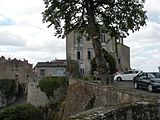
Parthenay
Parthenay | |
|---|---|
Subprefecture and commune | |
 | |
| Coordinates: 46°23′08″N 0°08′43″E / 46.3855°N 0.1452°E | |
| Country | France |
| Region | Nouvelle-Aquitaine |
| Department | Deux-Sèvres |
| Arrondissement | Parthenay |
| Canton | Parthenay |
| Intercommunality | Parthenay-Gâtine |
| Government | |
| • Mayor (2014–2020) | Xavier Argenton[1] |
| Area 1 | 11.38 km2 (4.39 sq mi) |
| Population (2014) | 10,367 |
| • Density | 910/km2 (2,400/sq mi) |
| Time zone | UTC+01:00 (CET) |
| • Summer (DST) | UTC+02:00 (CEST) |
| INSEE/Postal code | 79202 /79200 |
| Elevation | 114–184 m (374–604 ft) (avg. 149 m or 489 ft) |
| Website | www.ville-parthenay.fr |
| 1 French Land Register data, which excludes lakes, ponds, glaciers > 1 km2 (0.386 sq mi or 247 acres) and river estuaries. | |
Parthenay is a commune, an ancient fortified town, in the Deux-Sèvres department in the Nouvelle-Aquitaine region in western France. It is a subprefecture of the Deux-Sèvres department. It is also the capital of the arrondissement of Parthenay.
Geography
[change | change source]Parthenay is considered the capital of the Gâtine poitevine (or Gâtine de Parthenay), a region with bocages that is found in the central third of the department of Deux-Sèvres. It is at 28 km (17 mi) to the southeast of Bressuire, the other subprefecture of the department.
The city is at about 232 km (144 mi) from Bordeaux, 380 km (240 mi) from Paris, 871 km (541 mi) from Marseille and 468 km (291 mi) from Toulouse.
The commune has an area of 11.4 km2 (4.4 sq mi).[2] Its average altitude is 149 m (489 ft); at the city hall, the altitude is 169 m (554 ft).[3]

|
The commune of Parthenay is surrounded by the communes:
The Thouet river, a left tributary of the Loire river, flows through the city.
Climate
[change | change source]The climate of Parthenay, in the Köppen climate classification, is Cfb - Oceanic climate with template summers.[4]
Population
[change | change source]The inhabitants of Parthenay are known, in French, as Parthenaisiens (women: Parthenaisiennes).[5]
With a population of 10,367,[6] Parthenay has a population density of 911 inhabitants/km2.
Evolution of the population in Parthenay

Administration
[change | change source]Parthenay is a subprefecture of the Deux-Sèvres department, the capital of the arrondissement of Parthenay and the administrative centre (French: chef-lieu) of the canton of Parthenay.
It is part of the intercommunality Parthenay-Gâtine (French: Communauté de communes de Parthenay-Gâtine).
Twinned and partner towns
[change | change source] Manakara, Madagascar
 Weinstadt, Germany
 Arnedo, Spain
 Abrantes, Portugal
 Tsévié, Togo
 Tipperary, Ireland
 Edmundston, Canada
Gallery
[change | change source]References
[change | change source]- ↑ "Les élus du Conseil Municipal" (in French). Ville de Parthenay. Retrieved 20 April 2017.[permanent dead link]
- ↑ "Commune de Parthenay (79202)". Comparateur de territoire (in French). Institut national de la statistique et des études économiques - INSEE. Retrieved 19 April 2017.
- ↑ "Parthenay". Map-France.com. Retrieved 20 April 2017.
- ↑ Cite error: The named reference
annuairewas used but no text was provided for refs named (see the help page). - ↑ "Deux-Sèvres (79)" (in French). habitants.fr. Retrieved 20 April 2017.
- ↑ "Régions, départements, arrondissements, cantons et communes" (PDF). Populations légales 2014 (in French). Institut national de la statistique et des études économiques - INSEE. Retrieved 20 April 2017.
- ↑ "Comité de Jumelage - Parthenay" (in French). Ville de Parthenay. Archived from the original on 29 July 2017. Retrieved 20 April 2017.
Related pages
[change | change source]Other websites
[change | change source]- City Council website[permanent dead link] (in French)
- CC Parthenay-Gâtine Archived 2017-05-04 at the Wayback Machine (in French)


