Lela
| Lela | |
|---|---|
|
| |
 | |
 | |
| Verwaltung | |
| Land |
|
| Region |
|
| Département | Bas-Rhin (67) |
| Arrondissement | Sélestat-Erstein |
| Kanton | Mützig |
| Kommunalverband | Vallée de Villé |
| Amtlicha Name | Lalaye |
| Maire | Yvette Walspurger (2014-2020)[1] |
| Code Insee |
67255 |
| Boschtlaitzahl |
67220 |
| Aiwohner | |
| Aiwohner | 487 |
| Flech | 8,18 km2 |
| Bevelkerungsdicht | 53,55 Iiw./km2 |
| Lach | |
| Koordinate | 48° 19′ 49″ N, 7° 15′ 52″ E / 48.330277777778°N,7.2644444444444°EKoordinate: 48° 19′ 49″ N, 7° 15′ 52″ E / 48.330277777778°N,7.2644444444444°E |
| Hech | 303 m |
| Website | |
| https://www.lalaye.fr/ | |
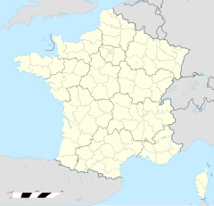
Lela (Patois, frz. Lalaye, elsässisch Lààch, daitsch Laach) isch e franzesische Gemää im Département Bas-Rhin (Unnaelsass) in de Rechion Grand Est (bis 2015 Elsass).
D Gemää gheat zum Kanton Mützig im Arrondissement Sélestat-Erstein.
Verwaltung
[Schaffe | Om Gwelltegschd schaffe]D Maire vun Lela isch d Yvette Walspurger. Lela gheat zum Kommunalvaband Vallée de Villé.
Bevelkerungsentwicklung
[Schaffe | Om Gwelltegschd schaffe]| 1801 | 1831 | 1851 | 1871 | 1900 | 1926 | 1946 | 1954 | 1962 | 1968 | 1975 | 1982 | 1990 | 1999 | 2006 | 2008 | 2012 |
|---|---|---|---|---|---|---|---|---|---|---|---|---|---|---|---|---|
| 695 | 999 | 934 | 961 | 884 | 628 | 485 | 450 | 394 | 405 | 365 | 346 | 364 | 390 | 439 | 440 | 430 |
Dialekt
[Schaffe | Om Gwelltegschd schaffe]De romanisch Dialekt vun Lela gheat zum Welche un domit zum Lorrain.
Weblinks
[Schaffe | Om Gwelltegschd schaffe]Fußnote
[Schaffe | Om Gwelltegschd schaffe]- ↑ (franzesisch) Liste des maires au 25 avril 2014 (data.gouv.fr)
Barembach | Bassemberg | Bellefosse | Belmont | Blancherupt | Bourg-Bruche | Braitebàch | Breitenau | Colroy-la-Roche | Dawiller | Diefebach | Dìnse | Driembàch | Erlebàch | Ewerhosle | Fouchy | Fouday | Grasswiller | Grit | Grossbrunn | Hellebari | Ìngerhosle | La Broque | Lalaye | Lìtzelhüse | Maisegott | Mìhlbàch | Mützig | Nàswil | Neikìrich | Neuviller-la-Roche | Plaine | Ranrupt | Rothau | Russ | Saales | Saint-Blaise-la-Roche | Saint-Maurice | Sàm Peterschulz | Sàm-Màrte | Saulxures | Schìrmeck | Solbàch | Steige | Stìll | Urbeis | Ürmott | Wàlderschbàch | Wildersbach | Willer | Wisches |


