Keratsini-Drapetsona
Uiterlijk
| Gemeente in Griekenland | |||
|---|---|---|---|
Situering
| |||
| Periferie | Attica | ||
| Coördinaten | 37° 57′ NB, 23° 37′ OL | ||
Algemeen
| |||
| Oppervlakte | 9,326 km² | ||
| Inwoners (2011[1]) |
91.090 (9.767 inw./km²) | ||
| Hoogte | 0 tot 100 m | ||
Politiek
| |||
| Burgemeester | Tzanis LOUKAS (sinds 2011) | ||
Overig
| |||
| Postcode(s) | 186 48, 187 55 - 187 58 | ||
| Netnummer(s) | 213 | ||
| Kenteken | Y | ||
| Website | (el) Gemeente | ||
| Detailkaart | |||

| |||
| Gemeentegrenzen 2011 | |||
| |||
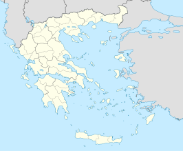
Keratsini-Drapetsona (Grieks: Κερατσίνι-Δραπετσώνα) is sedert 2011 een fusiegemeente (dimos) in de Griekse bestuurlijke regio (periferia) Attica.
De twee deelgemeenten (dimotiki enotita) van de fusiegemeente zijn:[2]
- Drapetsona (Δραπετσώνα)
- Keratsini (Κερατσίνι)
Overleden
[bewerken | brontekst bewerken]- Pavlos Fyssas (1979-2013), Grieks hiphop-artiest en antifascistisch activist
Bronnen, noten en/of referenties


