Simacota
Appearance
Simacota | |
|---|---|
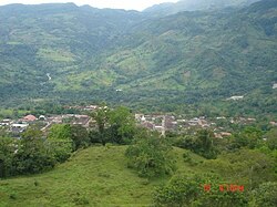
 View of Simacota | |
 Location of the town and municipality of Simacota in the Santander Department. | |
| Country | Colombia |
| Department | Santander |
| Government | |
| • Mayor (Alcalde) | Severiano Cala Cala(2008-2011) |
| Area | |
| • Total | 1,413 km2 (546 sq mi) |
| Population | |
| • Total | 7,845 |
| Website | www.simacota-santander.gov.co |
Simacota is a town and municipality in the Santander Department in northeastern Colombia. In 1965, the city had briefly been invaded by more than 100 members of the anti-government Ejército de Liberación Nacional (ELN), the "National Liberation Army") [1] and "captured the public imagination" in its first act as a new guerrilla organization.[2] The invaders murdered three of Simacota's four policemen, robbed the local bank, harassed the townspeople and looted the local pharmacy of its medicines, before being driven out by the Colombian Army. Only three of the 100 ELN men were captured.[3]
References
[edit]- ^ Jorge Pablo Osterling, Democracy in Colombia: Clientelist Politics and Guerrilla Warfare (Transaction Publishers, 1988) p246
- ^ René De La Pedraja, Wars of Latin America, 1948-1982: The Rise of the Guerrillas (McFarland, 2013) p193
- ^ "Guerrillas Active in Several Latin American Nations; Problem Called Serious in Five of Them", by Barnard L. Collier, Herald-Tribune Wire Service, in the Janesville (WI) Daily Gazette, January 30, 1965.
"100 Bandoleros Asaaltan a Sinacota, Santander", El Tiempo (Bogota, Colombia), January 8, 1965, p1
6°27′N 73°20′W / 6.450°N 73.333°W


