Gladstone (rehiyon)
Appearance
Paghimo ni bot Lsjbot. |
- Alang sa ubang mga dapit sa mao gihapon nga ngalan, tan-awa ang Gladstone.
| Gladstone | |
| Rehiyon | |
| Nasod | |
|---|---|
| Estado | State of Queensland |
| Gitas-on | 36 m (118 ft) |
| Tiganos | 24°01′07″S 151°39′29″E / 24.01869°S 151.65818°E |
| Population | 63,955 (2014-07-26) [1] |
| Timezone | AEST (UTC+10) |
| GeoNames | 7839580 |
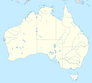
Rehiyon ang Gladstone sa Ostralya.[1] Nahimutang ni sa estado sa State of Queensland, sa sidlakang bahin sa nasod, 1,300 km sa amihanan sa Canberra ang ulohan sa nasod. Adunay 63,955 ka molupyo.[1]
Mga lungsod sa Gladstone:
Sa mosunod nga mga natural nga mga bahin makita sa Gladstone:
- Nabigasyon:
- Kapuloan:
- Mga bungtod:
- Auckland Hill (bungtod)
- Bald Hill (bungtod)
- Blackfellow (bungtod)
- Bottle Tree Hill (bungtod)
- Camelback (bungtod)
- Central Hill (bungtod)
- Coast Hill (bungtod)
- Dahls Hill (bungtod)
- Elizabeth Peak (bungtod)
- Fig Tree Hill (bungtod)
- Goat Hill (bungtod)
- Granite Hill (bungtod)
- Grassy Hill (bungtod)
- Hacking Hill (bungtod)
- Hummock Hill (bungtod)
- Limestone Hill (bungtod)
- Maude Hill (bungtod)
- Maurice Hill (bungtod)
- Mercy Hill (bungtod)
- Munro (bungtod)
- One Mile Hill (bungtod)
- One Tree Hill (bungtod)
- Palm Hill (bungtod)
- Phryne (bungtod)
- Rich Hill (bungtod)
- Round Hill (bungtod)
- Sandhill (bungtod)
- Scorrier Hill (bungtod)
- Sea Hill (bungtod)
- Ship Hill (bungtod)
- Six Mile Hill (bungtod)
- South Hill (bungtod)
- Specimen Hill (bungtod)
- Table Hill (bungtod)
- The Mole Hill (bungtod)
- Toowong Hill (bungtod)
- Turkey (bungtod)
- Two Mile Knob (bungtod)
- White Hill (bungtod)
- White Rock (bungtod)
- View Hill (bungtod)
- Wurdong Hill (bungtod)
- Mga lawis:
- Kabukiran:
- Amys Peak (tumoy sa bukid)
- Arthurs Seat (bukid)
- Bald Hill (bukid)
- Biondello (bukid)
- Booroon Booroon Mountain (bukid)
- Cedric Mountain (bukid)
- Curley (bukid)
- Dromedary Mountain (bukid)
- Gindoran Peak (tumoy sa bukid)
- Golegumma Mountain (bukid)
- Marble Mountain (bukid)
- Mount Alma (bukid)
- Mount Barker (bukid)
- Mount Barney (bukid)
- Mount Beecher (bukid)
- Mount Bennett (bukid)
- Mount Bomboolba (bukid)
- Mount Borilla (bukid)
- Mount Castletower (bukid)
- Mount Catfish (bukid)
- Mount Chapman (bukid)
- Mount Colosseum (bukid)
- Mount Coulston (bukid)
- Mount Despair (bukid)
- Mount Elmo (bukid)
- Mount Erebus (bukid)
- Mount Grevillea (bukid)
- Mount Grim (bukid)
- Mount Harper (bukid)
- Mount Holly (bukid)
- Mount Isabel (bukid)
- Mount Larcom (bukid)
- Mount Maria (bukid)
- Mount Martin (bukid)
- Mount McCabe (bukid)
- Mount Mcguire (bukid)
- Mount Molangul (bukid)
- Mount Moore (bukid)
- Mount Pack (bukid)
- Mount Redshirt (bukid)
- Mount Rideout (bukid)
- Mount Robert (bukid)
- Mount Rollo (bukid)
- Mount Seaview (bukid)
- Mount Stanley (bukid)
- Mount Stowe (bukid)
- Mount Sugarloaf (bukid)
- Mount Sugarloaf (bukid)
- Mount Tom (bukid)
- Mount Tom (bukid)
- Mount Warro (bukid)
- Mount Weary (bukid)
- Mount Wendy (bukid)
- North Gwynne (bukid)
- Pine Mountain (bukid)
- Rocky Point Mountain (bukid)
- Round Hill (bukid)
- Round Mountain (bukid)
- Scrubby Mountain (bukid)
- South Gwynne (bukid)
- The Dome (bukid)
- The Pack (bukid)
- Zamia Knob (bukid)
- Kagaangan:
- Mga gintang:
Ang klima kasarangan. Ang kasarangang giiniton 21 °C. Ang kinainitan nga bulan Enero, sa 24 °C, ug ang kinabugnawan Hulyo, sa 17 °C.[2] Ang kasarangang pag-ulan 1,253 milimetro matag tuig. Ang kinabasaan nga bulan Enero, sa 276 milimetro nga ulan, ug ang kinaugahan Septiyembre, sa 29 milimetro.[3]
| ||||||||||||||||||||||||||||||||||||||||||||||||||||||||||||||||||||||||||||||||||||||||||||||||||||||||||||||||||||||||||||
Ang mga gi basihan niini
[usba | usba ang wikitext]- ↑ 1.0 1.1 1.2 Gladstone sa GeoNames.Org (cc-by); post updated 2014-07-26; database download sa 2015-06-27
- ↑ 2.0 2.1 "NASA Earth Observations Data Set Index". NASA. Retrieved 30 Enero 2016.
- ↑ "NASA Earth Observations: Rainfall (1 month - TRMM)". NASA/Tropical Rainfall Monitoring Mission. Retrieved 30 Enero 2016.


