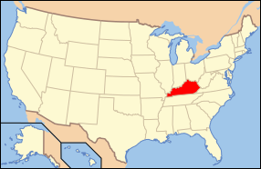
Fil:Map of USA KY.svg

Storleken för denna PNG-förhandsvisning av denna SVG-fil: 286 × 186 pixlar. Andra upplösningar: 320 × 208 pixlar | 640 × 416 pixlar | 1 024 × 666 pixlar | 1 280 × 832 pixlar | 2 560 × 1 665 pixlar.
Originalfil (SVG-fil, standardstorlek: 286 × 186 pixlar, filstorlek: 167 kbyte)
Filhistorik
Klicka på ett datum/klockslag för att se filen som den såg ut då.
| Datum/Tid | Miniatyrbild | Dimensioner | Användare | Kommentar | |
|---|---|---|---|---|---|
| nuvarande | 9 juni 2006 kl. 07.38 |  | 286 × 186 (167 kbyte) | Huebi~commonswiki | {{Information| |Description=Map of USA with Kentucky highlighted |other_versions=image:Map of USA with state names.svg }} Category:Maps of the United States Category:Maps of Kentucky Category:SVG maps {{GFDL-en}}{{cc-by-2.0}}{{cc-by-sa- |
Filanvändning
Mer än 100 sidor använder den här filen. Följande lista visar bara de 100 första sidorna som använder filen. Det finns en fullständig lista.
- Adair County, Kentucky
- Albany, Kentucky
- Alexandria, Kentucky
- Allen County, Kentucky
- Anderson County, Kentucky
- Arlington, Kentucky
- Ashland, Kentucky
- Audubon Park
- Bagdad, Kentucky
- Ballard County
- Bancroft, Kentucky
- Bardstown
- Barren County
- Bedford, Kentucky
- Beechwood Village
- Bellefonte, Kentucky
- Bellemeade
- Bellevue, Kentucky
- Bellewood
- Benham
- Benton, Kentucky
- Berea, Kentucky
- Berry, Kentucky
- Blackey
- Blaine, Kentucky
- Bloomfield, Kentucky
- Blue Ridge Manor
- Bonnieville
- Booneville, Kentucky
- Bowling Green, Kentucky
- Boyle County
- Bradfordsville
- Brandenburg, Kentucky
- Bremen, Kentucky
- Briarwood, Kentucky
- Brodhead, Kentucky
- Broeck Pointe
- Bromley, Kentucky
- Brooksville, Kentucky
- Brownsboro Farm
- Brownsboro Village
- Buckhorn
- Burgin
- Burkesville
- Burnside, Kentucky
- Butler, Kentucky
- Cadiz, Kentucky
- Calhoun, Kentucky
- California, Kentucky
- Calvert City
- Camargo, Kentucky
- Cambridge, Kentucky
- Campbellsburg, Kentucky
- Caneyville
- Carlisle, Kentucky
- Carroll County, Kentucky
- Carrsville
- Catlettsburg
- Cave City, Kentucky
- Christian County, Kentucky
- Clinton County, Kentucky
- Crittenden County, Kentucky
- Daviess County, Kentucky
- Edmonson County
- Fleming County
- Frankfort
- Franklin County, Kentucky
- Garrard County
- Grant County, Kentucky
- Graves County
- Henderson County, Kentucky
- Jackson County, Kentucky
- Jefferson County, Kentucky
- Knott County
- Knox County, Kentucky
- LaRue County
- Lee County, Kentucky
- Lewis County, Kentucky
- Lexington, Kentucky
- Lincoln County, Kentucky
- Livingston County, Kentucky
- Logan County, Kentucky
- Louisville
- Madison County, Kentucky
- Marion County, Kentucky
- Muhlenberg County
- Nelson County, Kentucky
- Ohio County, Kentucky
- Perry County, Kentucky
- Pulaski County, Kentucky
- Robertson County, Kentucky
- Rockcastle County
- Russell County, Kentucky
- Shelby County, Kentucky
- Todd County, Kentucky
- Trigg County
- Trimble County
- Union County, Kentucky
- Warren County, Kentucky
- Washington County, Kentucky
Visa fler länkar till den här filen.
Global filanvändning
Följande andra wikier använder denna fil:
- Användande på af.wikipedia.org
- Användande på ang.wikipedia.org
- Användande på an.wikipedia.org
- Användande på arz.wikipedia.org
- Användande på ay.wikipedia.org
- Användande på az.wiktionary.org
- Användande på bcl.wikipedia.org
- Användande på bi.wikipedia.org
- Användande på bpy.wikipedia.org
- Användande på bxr.wikipedia.org
- Användande på ca.wikipedia.org
- Användande på ce.wikipedia.org
- Användande på co.wikipedia.org
- Användande på cs.wikipedia.org
- Användande på cv.wikipedia.org
- Användande på da.wikipedia.org
- Användande på de.wikipedia.org
- Benutzer:Wolfgang1018/Wikipedia-Quiz
- Kategorie:Kentucky
- Vorwahlergebnisse der Präsidentschaftswahl in den Vereinigten Staaten 2008
- Weinbau in Kentucky
- Flaggen und Siegel der US-Bundesstaaten
- Vorwahlergebnisse der Präsidentschaftswahl in den Vereinigten Staaten 2016
- Vorwahlergebnisse der Präsidentschaftswahl in den Vereinigten Staaten 2020
- Vorwahlergebnisse der Präsidentschaftswahl in den Vereinigten Staaten 2024
- Användande på de.wiktionary.org
- Användande på el.wikipedia.org
- Användande på en.wikipedia.org
- List of state and territory name etymologies of the United States
- Category:Kentucky
- Pleasant Hill, Kentucky
- Abraham Lincoln Birthplace National Historical Park
- Ashland (Henry Clay estate)
- Category:Images of Kentucky
- Kentucky School for the Deaf
- St. John the Baptist Roman Catholic Church (Wilder, Kentucky)
- Kentucky High School Athletic Association
- Episcopal Burying Ground and Chapel (Lexington, Kentucky)
- Commodore Apartment Building (Louisville, Kentucky)
- Abner Gaines House
- Kentucky wine
- User:Sesh/Democratic Party Presidential Primaries 2008
- Bank of the Commonwealth (Kentucky)
- African Cemetery No. 2 (Lexington, Kentucky)
- Lincoln County Courthouse (Kentucky)
- Union County Courthouse (Kentucky)
- Downtown Greensburg Historic District (Greensburg, Kentucky)
- Lancaster Commercial Historic District (Lancaster, Kentucky)
Visa mer globalt användande av denna fil.


