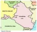
Íomhá:Kalmykia03.png
Cuma

Méid an réamhamhairc seo: 680 × 600 picteilín. Other resolutions: 272 × 240 picteilín | 544 × 480 picteilín | 738 × 651 picteilín.
Taispeáin leagan ardtaifigh den íomhá (738 × 651 picteilín, méid comhaid: 44 KB, cineál MIME: image/png)
Stair chomhaid
Cliceáil ar dáta/am chun an comhad a radharc mar a bhí sé ag an am sin.
| Dáta/Am | Mionsamhail | Toisí | Úsáideoir | Nóta tráchta | |
|---|---|---|---|---|---|
| faoi láthair | 10:48, 14 Bealtaine 2012 |  | 738 × 651 (44 KB) | WikiEditor2004 | Reverted to version as of 09:07, 14 May 2012 - trying to fix thumbnail problem once more |
| 09:18, 14 Bealtaine 2012 |  | 738 × 651 (44 KB) | WikiEditor2004 | Reverted to version as of 09:07, 14 May 2012 - thumbnail problem | |
| 09:17, 14 Bealtaine 2012 |  | 571 × 487 (14 KB) | WikiEditor2004 | Reverted to version as of 16:09, 29 December 2006 - thumbnail problem | |
| 09:07, 14 Bealtaine 2012 |  | 738 × 651 (44 KB) | WikiEditor2004 | improved version | |
| 16:09, 29 Nollaig 2006 |  | 571 × 487 (14 KB) | Electionworld | {{ew|en|PANONIAN}} Map made by PANONIAN {{PD-user|PANONIAN}} Category:Maps of the Russian republics |
Úsáid comhaid
Tá nasc chuig an gcomhad seo ar na leathanaigh seo a leanas:
Global file usage
Úsáidtear an comhad seo ar na vicithe seo a leanas:
- Úsáid ar ace.wikipedia.org
- Úsáid ar an.wikipedia.org
- Úsáid ar ast.wikipedia.org
- Úsáid ar bg.wikipedia.org
- Úsáid ar bn.wikipedia.org
- Úsáid ar bs.wikipedia.org
- Úsáid ar bxr.wikipedia.org
- Úsáid ar cs.wikipedia.org
- Úsáid ar cv.wikipedia.org
- Úsáid ar cy.wikipedia.org
- Úsáid ar da.wikipedia.org
- Úsáid ar de.wikipedia.org
- Úsáid ar diq.wikipedia.org
- Úsáid ar en.wikipedia.org
- Úsáid ar eo.wikipedia.org
- Úsáid ar es.wikipedia.org
- Úsáid ar et.wikipedia.org
- Úsáid ar fa.wikipedia.org
- Úsáid ar fi.wikipedia.org
- Úsáid ar fr.wikipedia.org
- Úsáid ar gag.wikipedia.org
- Úsáid ar he.wikipedia.org
- Úsáid ar hi.wikipedia.org
- Úsáid ar hr.wikipedia.org
- Úsáid ar hu.wikipedia.org
- Úsáid ar id.wikipedia.org
- Úsáid ar incubator.wikimedia.org
- Úsáid ar ja.wikipedia.org
- Úsáid ar ka.wikipedia.org
- Úsáid ar kbd.wikipedia.org
- Úsáid ar ko.wikipedia.org
- Úsáid ar kv.wikipedia.org
- Úsáid ar la.wikipedia.org
- Úsáid ar mk.wikipedia.org
- Úsáid ar mn.wikipedia.org
- Úsáid ar mr.wikipedia.org
- Úsáid ar ms.wikipedia.org
- Úsáid ar myv.wikipedia.org
- Úsáid ar nl.wikipedia.org
- Úsáid ar nn.wikipedia.org
- Úsáid ar no.wikipedia.org
- Úsáid ar pl.wikipedia.org
View more global usage of this file.


