Stade du Ray
Appearance
(Redirected from Stade Municipal du Ray)
 | |
 | |
| Full name | Stade Municipal du Ray |
|---|---|
| Location | Nice, France |
| Owner | City of Nice |
| Capacity | 17,415 |
| Surface | Grass |
| Construction | |
| Built | 1897 |
| Opened | 30 January 1927 |
| Renovated | 1948, 1979, 1992, 1997 |
| Closed | 2013 |
| Demolished | 2017 |
| Tenants | |
| OGC Nice (1927–2013) | |
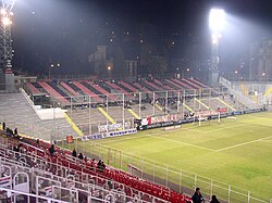
Stade Municipal du Ray was a football stadium in Nice, France. It was the home of OGC Nice since it opened in 1927 and had a capacity of 17,415.[1] It was popular for being located in the center of the city, but suffered from its old structure and small capacity. The red and black colored stadium was mostly used for football. A new stadium was supposed to be built in the Lingostière side, but the project was cancelled in 2006. The stadium was replaced by the Allianz Riviera in September 2013.
References
[edit]- ^ "Le Stade du Ray". OGC Nice. Archived from the original on 21 June 2013. Retrieved 15 July 2019.
External links
[edit] Media related to Stade du Ray at Wikimedia Commons
43°43′23.98″N 7°15′31.52″E / 43.7233278°N 7.2587556°E

