R281 road (Ireland)
Appearance
| R281 road | ||||
|---|---|---|---|---|
| Bóthar R281 | ||||
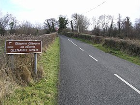
 At the Glenaniff River in Tawnaleck, County Leitrim | ||||
| Route information | ||||
| Length | 30.6 km[1] (19.0 mi) | |||
| Major junctions | ||||
| From | ||||
| ||||
| To | ||||
| Location | ||||
| Country | Ireland | |||
| Primary destinations |
| |||
| Highway system | ||||
| ||||
The R281 road is a regional road in Ireland linking Kinlough and Glenfarne in County Leitrim.[2]
From Kinlough the road passes along the south shore of Lough Melvin before joining the R282 near Rossinver. After about 1 km (0.6 mi) the R281 leaves the R282 towards Kiltyclogher.[1] In Kiltyclogher, a monument to Seán Mac Diarmada, a leader of the 1916 Easter Rising, occupies the roundabout junction with the R283.[3] From here the road continues southeast to end in Glenfarne. The road is 30.8 km (19.1 mi) long.[1]
See also
[edit]References
[edit]- ^ a b c "R281 to N16" (Map). Google Maps. Retrieved 20 February 2016.
- ^ "Roads Act 1993 (Classification of Regional Roads) Order 2012". Government of Ireland. 28 February 2012. Retrieved 20 February 2016.
- ^ "Seán MacDermott Monument". Department of Culture, Heritage and the Gaeltacht. Retrieved 4 June 2016.


