Naval Outlying Landing Field Holley
Appearance
Naval Outlying Landing Field Holley | |||||||||||||||
|---|---|---|---|---|---|---|---|---|---|---|---|---|---|---|---|
| Summary | |||||||||||||||
| Airport type | Military | ||||||||||||||
| Owner/Operator | U.S. Navy / Gulf Power | ||||||||||||||
| Location | Navarre, Florida | ||||||||||||||
| Time zone | CST (UTC -6:00) | ||||||||||||||
| Elevation AMSL | 39 ft / 12 m | ||||||||||||||
| Coordinates | 30°25′51″N 086°53′59″W / 30.43083°N 86.89972°W | ||||||||||||||
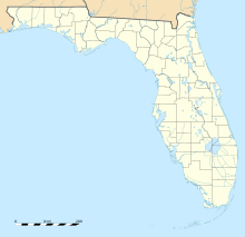
| Map | |||||||||||||||
 | |||||||||||||||
| Runways | |||||||||||||||
| |||||||||||||||
Naval Outlying Landing Field (NOLF) Holley was a naval outlying landing field of the larger Naval Air Station Whiting Field located within the community of Navarre, Florida. The two runways were each 3,600 feet (1,100 meters) long.[1] The runways were restricted to limited military use only; however, in 2017, the Gulf Power company was authorized to build a solar power plant on the facility grounds.[2][3] The plant now provides power for some 18,000 homes, making it one of the largest solar fields in the region.[3] The solar panels completely cover what were once the runways.[citation needed]
See also
[edit]References
[edit]- ^ "FAA Information about Holley Nolf Airport (NKL)". www.airport-data.com. Retrieved 2016-12-20.
- ^ Staff reports. "Military marks completion of Panhandle solar fields". Panama City News Herald. Retrieved 2019-03-15.
- ^ a b DelaHaya, Rick (2017-01-18). "The first solar panels installed on large-scale solar projects at Eglin AFB and NAS Pensacola". Gulf Power NewsCenter. Retrieved 2019-03-15.


