Gulf of Ob
| Gulf of Ob | |
|---|---|
| Обская губа (Russian) | |
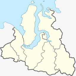
 Map showing the location of the Gulf of Ob. | |
| Location | Far North |
| Coordinates | 68°50′N 73°30′E / 68.833°N 73.500°E |
| River sources | Ob |
| Ocean/sea sources | Kara Sea |
| Basin countries | Russia |
| Average depth | 10–12 m (33–39 ft) |
| Official name | Islands in Ob Estuary, Kara Sea |
| Designated | 13 September 1994 |
| Reference no. | 676[1] |

The Gulf of Ob (Russian: Обская губа, romanized: Obskaya guba), also known as the Bay of Ob (Russian: Обский залив, romanized: Obsky zaliv), is a bay of the Arctic Ocean, located in northern Russia at the mouth of the Ob River.[2] It is the world's longest estuary.[3]
Geography
[edit]The mouth of the Gulf of Ob is in the Kara Sea between the Gyda and Yamal peninsulas.[2] It is about 1,000 km (620 mi) long and varies in width from about 50 to 80 km (31 to 50 mi). It generally runs north and south.[2] The gulf is relatively shallow, with an average depth from 10 to 12 metres (33 to 39 ft), which restricts heavy sea transport. The Taz Estuary is an eastern side-branch formed by the Taz River.
There are several islands near the mouth of the Ob, at the beginning of the estuary, such as Khaley Island. All these islands are close to the shore and they are generally flat and low-lying. They are protected wetlands under Ramsar.[1] Further north, except for a few islands located close to the shore, such as Khalevigo and Nyavigo, the Gulf of Ob is free of islands until it meets the Kara Sea.
Beluga whales seasonally migrate to the Gulf of Ob.[4]
Fossil fuels
[edit]Very large natural gas and petroleum deposits have been discovered in this region. To the west is the Yamal project to develop resources in the Yamal Peninsula. To the south-east the Yamburg gas field is the world's third largest natural gas field, located between the southern portion of the gulf and the Taz Estuary to the east. Oil and gas from the wells are sent south via pipeline and rail transport.[citation needed]
A new port has been developed at Sabetta, on the west bank of the gulf, to support the Yamal LNG plant.[5] Commercial operation started in December 2017 with the loading of the first LNG carrier.[6]
Gazprom's Arctic Gate offshore oil loading terminal is in the gulf, designed to operate where ice could be over two meters thick.[7][8]
The fossil gas company PAO Novatek has since 2019 had permission for natural gas extraction from a major part of the eastern shore Gyda Peninsula.[9][10] In 2020 the company presented plans for construction of a major port for gas shipment. The port is called Utrenneye and the project is named Arctic LNG 2.[11][12][13]
References
[edit]- ^ a b "Islands in Ob Estuary, Kara Sea". Ramsar Sites Information Service. Retrieved 25 April 2018.
- ^ a b c "Gulf of Ob". www.eosnap.com/ Earthsnapshot.com. Archived from the original on 2012-03-20.
- ^ "Longest estuary". divingalmanac.com. Archived from the original on 2019-02-07. Retrieved 2019-02-05.
- ^ Solovyev A. B..Platonov G. N.. Glazov M. D.. hpak V. O.. V. V. Rozhnov V. V.. 2012. "Distribution of beluga whales (Delphinapterus leucas) in the Russian Arctic seas according to the results of expedition aboard RV Mikhail Somov, September–November 2010. December 2012, Biology Bulletin, Volume 39, Issue 7, pp.654–658, doi:10.1134/S1062359012070102, SpringerLink
- ^ "Port of Sabetta". Ship Technology. Retrieved 12 January 2015.
- ^ Foy, Henry (2017-12-08). "Russia ships first gas from $27bn Arctic project". Financial Times. Retrieved 2018-06-10.
- ^ "Yamal". Gazprom. Archived from the original on 23 December 2021. Retrieved 8 November 2021.
- ^ Staalesen, Atle (16 December 2020). "Ships flock in icy Ob Bay as new grand seaport rises". The Barents Observer. Retrieved 8 November 2021.
- ^ "Novatek adds several trillion cubic meters to its Arctic reserves". BarentsObserver. 8 January 2020. Retrieved 30 December 2023.
- ^ "Our assets". Novatek. Retrieved 29 April 2020.
- ^ "Here comes Russia's next grand Arctic seaport". BarentsObserver. 12 June 2019. Retrieved 30 December 2023.
- ^ "New Arctic terminal will be built twice bigger than planned". BarentsObserver. 16 April 2020. Retrieved 30 December 2023.
- ^ "Arctic LNG 2 is another LNG production-related project of NOVATEK". Novatek. Retrieved 29 April 2020.
External links
[edit]


