Gilroy Road station
Appearance
Gilroy Road | |||||||||||
|---|---|---|---|---|---|---|---|---|---|---|---|
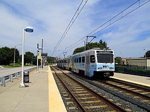
 A northbound train at Gilroy Road station in August 2014 | |||||||||||
| General information | |||||||||||
| Location | 10903 Gilroy Road Hunt Valley, Maryland | ||||||||||
| Coordinates | 39°28′54.67″N 76°39′42.92″W / 39.4818528°N 76.6619222°W | ||||||||||
| Owned by | Maryland Transit Administration | ||||||||||
| Platforms | 2 side platforms | ||||||||||
| Tracks | 2 | ||||||||||
| Construction | |||||||||||
| Accessible | Yes | ||||||||||
| History | |||||||||||
| Opened | September 9, 1997[1] | ||||||||||
| Passengers | |||||||||||
| 2017 | 223 daily[2] | ||||||||||
| Services | |||||||||||
| |||||||||||
| |||||||||||
Gilroy Road station is a Baltimore Light Rail station located in an industrial park in Hunt Valley, Maryland. It opened in 1997 as part of the system's northern extension. The station has two side platforms serving two tracks.
References
[edit]- ^ "Maryland Department of Transportation Maryland Transit Administration Media Guide" (PDF). Maryland Department of Transportation Maryland Transit Administration. 2017. pp. 15–16. Archived from the original (PDF) on April 12, 2018.
- ^ "Light Rail Link Cornerstone Plan" (PDF). Maryland Department of Transportation Maryland Transit Administration. p. 15.
External links
[edit]![]() Media related to Gilroy Road station at Wikimedia Commons
Media related to Gilroy Road station at Wikimedia Commons


