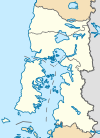
File:Los Lagos location map.svg
Appearance

Size of this PNG preview of this SVG file: 200 × 276 pixels. Other resolutions: 174 × 240 pixels | 348 × 480 pixels | 556 × 768 pixels | 742 × 1,024 pixels | 1,484 × 2,048 pixels.
Original file (SVG file, nominally 200 × 276 pixels, file size: 931 KB)
File history
Click on a date/time to view the file as it appeared at that time.
| Date/Time | Thumbnail | Dimensions | User | Comment | |
|---|---|---|---|---|---|
| current | 21:01, 22 October 2017 |  | 200 × 276 (931 KB) | Janitoalevic | Límites más precisos. |
| 19:32, 16 July 2016 |  | 200 × 276 (1.04 MB) | Janitoalevic | Added maritime border of Palena Province. | |
| 18:44, 12 July 2016 |  | 200 × 276 (1.04 MB) | Janitoalevic | User created page with UploadWizard |
File usage
The following 28 pages use this file:
- 2024 Women's U21 South American Volleyball Championship
- Aguas Calientes Hot Springs
- Calbuco Channel
- Calbuco Island
- Church of Aldachildo
- Church of Caguach
- Church of Chelín
- Church of Chonchi
- Church of Colo
- Church of Detif
- Church of Ichuac
- Church of Nercón
- Church of Our Lady of Sorrows, Dalcahue
- Church of Quinchao
- Church of Rilán
- Church of San Francisco, Castro
- Church of San Juan Bautista, Dalcahue
- Church of Santa María de Loreto, Achao
- Church of Tenaún
- Church of Vilupulli
- Constancia Lake
- Puyehue Hot Springs
- Puyehue Lake
- Rupanco Lake
- Todos los Santos Lake
- User:Muwatallis II/sandbox/003
- Module:Location map/data/Chile Los Lagos
- Module:Location map/data/Chile Los Lagos/doc
Global file usage
The following other wikis use this file:
- Usage on ar.wikipedia.org
- Usage on de.wikipedia.org
- Osorno
- Lago Llanquihue
- Frutillar
- Puerto Octay
- Puerto Varas
- Lago Rupanco
- Estadio Regional de Chinquihue
- Chaitén (Vulkan)
- Wikipedia:Kartenwerkstatt/Positionskarten/Südamerika
- Apagado
- Hornopirén (Vulkan)
- Lago Chapo
- Mechuque
- Yate (Vulkan)
- Vorlage:Positionskarte/Rahmen
- Paso Fronterizo Cardenal Samoré
- Chiloé-Archipel
- Vorlage:Positionskarte/Rahmen/Doku
- Lago Todos los Santos
- Reloncaví-Fjord
- Michinmahuida
- Kraftwerk Canutillar
- Vorlage:Positionskarte Chile Los Lagos
- Saltos de Petrohué
- Golf von Corcovado
- Futaleufú (Kommune)
- Golf von Ancud
- Estadio Municipal Rubén Marcos Peralta
- Usage on eo.wikipedia.org
- Usage on es.wikipedia.org
View more global usage of this file.


