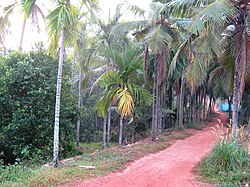
Kannur East
Appearance
(Redirected from Elayavoor)
Kannur East | |
|---|---|
city | |
 Varam village | |
 | |
| Coordinates: 11°53′0″N 75°24′0″E / 11.88333°N 75.40000°E | |
| Country | |
| State | Kerala |
| District | Kannur |
| Area | |
• Total | 11.57 km2 (4.47 sq mi) |
| Population (2019) | |
• Total | 31,545 |
| • Density | 2,700/km2 (7,100/sq mi) |
| Languages | |
| • Official | Malayalam, English |
| Time zone | UTC+5:30 (IST) |
| ISO 3166 code | IN-KL |


Kannur East is suburb of Kannur city in Kerala, India.
Townships and villages
[edit]- Elayavoor. 31,545 people.
- Varam. 14,739 people
- Eachur. 30,021 people
- Chelora. 36,500 people
- Chakkarakkal. 26,500 people
- Kanhirode. 13,954 people
Important Landmarks
[edit]- Koodali Higher Secondary School
- CHMHSS Elayavoor
- Vivekananda Vidyalayam
- Regional Paultry farm or Central Hatchery
- Kadakkara Sri Dharmasastha kshetram
- Valiannur Rishieswara Kshetram
- Chelora Someshwary Kshetram
- Chelora Govt. Higher Secondary School
- Mini industrial estate, Chelora
- Mundayad indoor stadium
- Mundayad Juma Masjid
- Elayavoor Kshetram
- Varam Sree Vishwakarma Devi Kshethram
Munderi Bird Sanctuary
[edit]Munderi Kavu bird sanctuary is famous for migratory birds. The area is rich in biodiversity and is waiting to get developed as an eco-tourism hot spot.[1]
Elayavoor
[edit]Elayavoor is a suburb adjacent to Kannur city. This place was formerly a village famous for its paddy field but due to fast urbanization most of the paddy fields have disappeared.
Location
[edit]References
[edit]Wikimedia Commons has media related to Kannur East.

