Caquetá Territory
Appearance
This article includes a list of references, related reading, or external links, but its sources remain unclear because it lacks inline citations. (August 2023) |


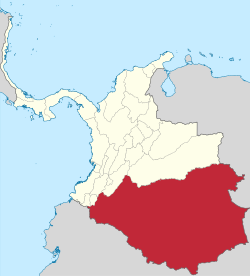
The Caquetá Territory (Spanish: Territorio del Caquetá) was a national territory of the Republic of New Granada and the subsequent states of the Granadine Confederation and the United States of Colombia from 1845 to 1886. Its capital was Mocoa.
History
[edit]The Caquetá Territory was created on May 2, 1845, as a national territory of the Republic of New Granada. Its territory was carved out of the Popayan Province.
In the 1863 constitution it was made a part of the Cauca State.
In 1886, the territory was disestablished and its lands transferred to Gran Cauca.

