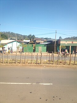
Bitena
Bitena
| |
|---|---|
Town | |
 Road in Bitana town | |
| Coordinates: 6°57′49″N 38°02′04″E / 6.96361°N 38.03444°E | |
| Country | |
| Region | |
| Zone | Wolaita |
| District | Diguna Fango |
| Population (2007) | |
| • Total | 13,294 |
| Time zone | UTC+3 (EAT) |
Bitena (Amharic: ቢጠና; Wolaytta: Biixanna) is a town in Wolayita Zone, South Ethiopia Regional State, Ethiopia.[1] It is administrative capital of Diguna Fango district of Wolayita Zone, Ethiopia. Bitena is located about 355 km away from Addis Ababa to the south on the path Addis-Hawassa-Dimtu-Sodo and 45 km away from Sodo, the capital of Wolaita Zone[citation needed]. It also specifically located between 22 km West of Dimtu town and 7 km northeast of Kercheche town. Bitena lies between 6°57'52.6"N 38°02'08.7"E.[2][3]
Demography
[edit]Based on the 2007 population projection by the Central Statistical Agency of Ethiopia, Bitena has a total population of 13,294, of whom 8,855 are women and 4,439 are men.[4] The majority of the inhabitants were Protestants (96.61%) and 2.0% practiced Ethiopian Orthodox Christianity, and 1.39% were Catholics.[1]
References
[edit]- ^ a b CSA, UNCS, Field Survey. "Map of SNNPR" (PDF). Reliefweb.int. Archived (PDF) from the original on 27 October 2021. Retrieved 20 October 2020.
{{cite web}}: CS1 maint: multiple names: authors list (link) - ^ elevationmap.net. "Bitena Town, Diguna Fango, Wolayita, Ethiopia on the Elevation Map. Topographic Map of Bitena Town, Diguna Fango, Wolayita, Ethiopia". elevationmap.net. Archived from the original on 14 March 2023. Retrieved 21 October 2020.
- ^ Bitena in Google maps
- ^ "EthioInfo". CSA. Central Statistical Agency of Ethiopia.


