Category:Shires of Scotland
Jump to navigation
Jump to search
historic administrative and geographical division of Scotland | |||||
| Upload media | |||||
| Instance of | |||||
|---|---|---|---|---|---|
| Subclass of |
| ||||
| Location | Britain | ||||
| Has part(s) |
| ||||
| Partially coincident with |
| ||||
| |||||
The Shires of Scotland are historic subdivisions of Scotland. For most purposes they were superseded in 1975 by the District Regional Councils and are now used only for land registration, lieutenancy areas, and for various county associations including County Chambers of Commerce. (→Shires of Scotland).
Traditional counties (shires) of Scotland: Aberdeenshire · Angus · Argyll · Ayrshire · Banffshire · Berwickshire · Buteshire · Caithness · Clackmannanshire · Cromartyshire · Dumbartonshire · Dumfriesshire · East Lothian · Fife · Inverness-shire · Kincardineshire · Kinross-shire · Kirkcudbrightshire · Lanarkshire · Midlothian · Moray · Nairnshire · Orkney Islands · Peeblesshire · Perthshire · Renfrewshire · Ross-shire · Roxburghshire · Selkirkshire · Shetland Islands · Stirlingshire · Sutherland · West Lothian · Wigtownshire
Subcategories
This category has the following 40 subcategories, out of 40 total.
Pages in category "Shires of Scotland"
This category contains only the following page.
Media in category "Shires of Scotland"
The following 30 files are in this category, out of 30 total.
-
Dunbartonshire Map.png 4,967 × 4,967; 6.78 MB
-
East Lothian Map.png 4,967 × 4,967; 6.72 MB
-
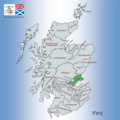
Fife Map.png 4,967 × 4,967; 6.8 MB
-
Inverness-shire Map.png 4,967 × 4,967; 6.76 MB
-
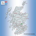
Kincardineshire Map.png 4,967 × 4,967; 6.78 MB
-
Kinross-shire Map.png 4,967 × 4,967; 6.79 MB
-
Kirkcudbrightshire Map.png 4,967 × 4,967; 6.62 MB
-
Lanarkshire Map.png 4,967 × 4,967; 6.8 MB
-
Map showing the traditional, geographical counties of Scotland.png 4,967 × 4,967; 6.84 MB
-
Map showing the traditional, geographical county of Argyllshire, Scotland.png 4,967 × 4,967; 7.55 MB
-
Map showing the traditional, geographical county of Ayrshire, Scotland.png 4,967 × 4,967; 6.8 MB
-
Map showing the traditional, geographical county of Banffshire, Scotland.png 4,967 × 4,967; 6.64 MB
-
Map showing the traditional, geographical county of Berwickshire, Scotland.png 4,967 × 4,967; 6.74 MB
-
Map showing the traditional, geographical county of Buteshire, Scotland.png 4,967 × 4,967; 6.8 MB
-
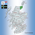
Map showing the traditional, geographical county of Caithness, Scotland.png 4,967 × 4,967; 6.6 MB
-
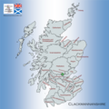
Map showing the traditional, geographical county of Clackmannanshire, Scotland.png 4,967 × 4,967; 6.77 MB
-
Midlothian Map.png 4,967 × 4,967; 6.78 MB
-
Morayshire Map.png 4,967 × 4,967; 6.64 MB
-
Nairnshire Map.png 4,967 × 4,967; 6.78 MB
-
Orkney County Map.png 4,967 × 4,967; 6.57 MB
-
Peeblesshire Map.png 4,967 × 4,967; 6.82 MB
-
Perthshire Map.png 4,967 × 4,967; 6.78 MB
-
Renfrewshire Map.png 4,967 × 4,967; 6.78 MB
-
Ross-shire and Cromartyshire Map.png 4,967 × 4,967; 6.72 MB
-
Roxburghshire Map.png 4,967 × 4,967; 6.77 MB
-
Selkirkshire Map.png 4,967 × 4,967; 6.81 MB
-
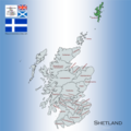
Shetland Map.png 4,967 × 4,967; 6.78 MB
-
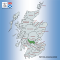
Stirlingshire Map.png 4,967 × 4,967; 6.78 MB
-
Sutherland Map.png 4,967 × 4,967; 6.56 MB
-
Wigtownshire Map.png 4,967 × 4,967; 6.83 MB


