Category:Maps of conflicts in 2016
Jump to navigation
Jump to search
Media in category "Maps of conflicts in 2016"
The following 52 files are in this category, out of 52 total.
-
2011 SPLM-N South Kordofan Frontlines Map.svg 2,970 × 2,091; 1.55 MB
-
Strikes in Syria and Iraq 2014-09-23 (cropped).jpg 940 × 704; 106 KB
-
Strikes in Syria and Iraq 2014-09-23.jpg 953 × 715; 114 KB
-
Rif Aleppo2.svg 1,293 × 655; 7.13 MB
-
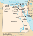
Sinai insurgency.svg 499 × 796; 246 KB
-
Sinai map.PNG 327 × 350; 30 KB
-
Political map Afar triangle.png 373 × 454; 436 KB
-
He Darfur map.PNG 330 × 355; 13 KB
-
IDP's in Northern Uganda.png 495 × 541; 61 KB
-
Insurgency Maghreb.png 476 × 281; 10 KB
-
Mosul offensive (2015) map.png 588 × 454; 68 KB
-
Lucanamarca (Perú).JPG 526 × 721; 45 KB
-
Mexico states map small war.PNG 442 × 306; 51 KB
-
Armed conflict zones in Myanmar.png 1,324 × 2,938; 258 KB
-
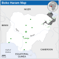
Boko Haram insurgency map.svg 954 × 734; 399 KB
-
Islamist insurgency in Nigeria-es.svg 600 × 600; 921 KB
-
Islamist insurgency in Nigeria.svg 254 × 254; 412 KB
-
Pakistan-Waziristan-Map.png 700 × 692; 96 KB
-
PKK-Conflict-de.png 2,372 × 1,323; 1.98 MB
-
Sendero Luminoso.png 400 × 579; 33 KB
-
South Russia geopolitics 2015.jpg 810 × 769; 571 KB
-
South Sudan conflict map.png 500 × 363; 69 KB
-
South Yemen.png 800 × 513; 77 KB
-
Syrian civil war.png 2,502 × 2,107; 1,020 KB
-
Syrian Civil War map.svg 922 × 762; 3.56 MB
-
Terror-attack-brussels-03-2016-map-GER.svg 977 × 746; 5.25 MB
-
Ugandan districts affected by Lords Resistance Army.png 596 × 735; 92 KB
-
2014 Russo-ukrainian-conflict map.svg 4,126 × 4,480; 2.75 MB
-
2014 Ukraine War02.PNG 2,171 × 2,736; 1.79 MB
-
2014ko Ukraina ekialdeko gatazka armatua.png 1,816 × 2,056; 678 KB
-
Battle of Debaltseve.png 472 × 277; 92 KB
-
Donetsk and Luhansk People Republics en.jpg 1,240 × 1,754; 405 KB
-
Donetsk People's Republic (2014-04-30).svg 659 × 891; 120 KB
-
Donrepublicraions.png 2,000 × 2,731; 468 KB
-
DPR LPR en.jpg 2,340 × 3,336; 1.29 MB
-
DPR LPR uk.jpg 2,480 × 3,508; 1.03 MB
-
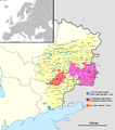
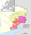
East Ukraine conflict (English language version).png 2,048 × 2,701; 1,012 KB
-
East Ukraine Conflict RBK.svg 2,048 × 2,701; 1.98 MB
-
East Ukraine conflict.png 2,048 × 2,701; 1.43 MB
-
Federal State of New Russia.svg 815 × 1,075; 688 KB
-
Guerra civil Donbass.png 1,816 × 2,056; 868 KB
-
Insurgencia en Donbass.png 2,048 × 2,701; 1.14 MB
-
Map of the war in Donbass.svg 2,270 × 2,702; 2.83 MB
-
Map of war in eastern Ukraine in 08.08.14.png 2,000 × 2,638; 1.58 MB
-
War in donbass.svg 570 × 800; 79 KB
-
Военный конфликт на востоке Украины.svg 2,048 × 2,701; 1.97 MB
-
Военный конфликт на востоке Украины2.jpg 2,048 × 2,701; 1.07 MB
-
Карта боевых действий на Востоке Украины-b.svg 2,048 × 2,701; 2.09 MB
-
Карта боевых действий на Востоке Украины.svg 2,048 × 2,701; 2.17 MB
-
Yemeni Civil War.svg 1,625 × 1,061; 923 KB
-
Zonas donde se ha registrado actividad de Sendero Luminoso.png 466 × 674; 112 KB


