Category:Maps of Seychelles
Jump to navigation
Jump to search
Countries of Africa: Algeria · Angola · Benin · Botswana · Burkina Faso · Burundi · Cameroon · Cape Verde · Central African Republic · Chad · Comoros · Democratic Republic of the Congo · Republic of the Congo · Djibouti · Egypt‡ · Equatorial Guinea · Eritrea · Eswatini · Ethiopia · Gabon · The Gambia · Ghana · Guinea · Guinea-Bissau · Ivory Coast · Kenya · Lesotho · Liberia · Libya · Madagascar · Malawi · Mali · Mauritania · Mauritius · Morocco · Mozambique · Namibia · Niger · Nigeria · Rwanda · São Tomé and Príncipe · Senegal · Seychelles · Sierra Leone · Somalia · South Africa · South Sudan · Sudan · Tanzania · Togo · Tunisia · Uganda · Zambia · Zimbabwe
Limited recognition: Ambazonia · Azawad · Puntland · Sahrawi Arab Democratic Republic · Somaliland – Other areas: Canary Islands · Ceuta · Madeira · Mayotte · Melilla · Réunion · Saint Helena, Ascension and Tristan da Cunha · Scattered Islands in the Indian Ocean · Western Sahara
‡: partly located in Africa
Wikimedia category | |||||
| Upload media | |||||
| Instance of | |||||
|---|---|---|---|---|---|
| Category combines topics | |||||
 | |||||
Subcategories
This category has the following 12 subcategories, out of 12 total.
Pages in category "Maps of Seychelles"
The following 2 pages are in this category, out of 2 total.
Media in category "Maps of Seychelles"
The following 30 files are in this category, out of 30 total.
-
Seychelles Inner Islands.png 534 × 431; 19 KB
-
MZ Aldabra.PNG 906 × 501; 14 KB
-
Amirantes-Sat.png 894 × 1,897; 2.87 MB
-
Aride roheline.png 1,583 × 1,055; 80 KB
-
Base Map of the Seychelles.png 1,100 × 696; 178 KB
-
Curieuse roheline.png 1,583 × 1,055; 79 KB
-
D'Arros and Saint Joseph map.png 900 × 714; 637 KB
-
ECDM 20160421 Mad Sey TC FANTALA.pdf 1,625 × 1,125; 565 KB
-
ECHO Seychelles Editable A4 Landscape.pdf 1,754 × 1,239; 208 KB
-
ECHO Seychelles Editable A4 Landscape.png 1,123 × 794; 207 KB
-
Felicite saar.png 1,280 × 853; 104 KB
-
FLII Seychelles.png 1,271 × 684; 55 KB
-
Geografia de seychelles CA.jpg 700 × 369; 47 KB
-
Geografia de seychelles ES.jpg 700 × 369; 48 KB
-
Grande Sœur.png 1,583 × 1,055; 81 KB
-
La Digue roheline.png 1,583 × 1,055; 82 KB
-
Mahe roheline.png 1,339 × 1,063; 81 KB
-
Marianne, Seychelles.png 1,339 × 1,063; 64 KB
-
PAT - Seychelles.gif 975 × 920; 39 KB
-
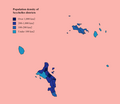
Population density of Seychelles districts.png 1,387 × 1,205; 94 KB
-
Praslin roheline.png 1,583 × 1,055; 92 KB
-
SC-Districts numbered.png 475 × 601; 17 KB
-
Seychelles (Principal group) - DPLA - ce22ebd3e7747c2de848d0138381e002.jpg 2,554 × 3,284; 6.43 MB
-
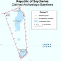
Seychelles Archipelagic Waters Group 2.png 591 × 593; 186 KB
-
Seychelles Gulper Shark Range.png 213 × 179; 8 KB
-
Seychelles Population Density, 2000 (5457019243).jpg 2,396 × 3,100; 507 KB
-
Seychelles Population Density, 2000 (6172448824).jpg 2,322 × 3,160; 517 KB
-
Silhouette roheline.png 1,339 × 1,063; 70 KB
-
Ste. Anne Marine National Park.png 475 × 601; 15 KB
-
Übersichtskarte Seychellen.png 697 × 369; 167 KB


