Category:Maps of Jamaica
Jump to navigation
Jump to search
Countries of North America: Antigua and Barbuda · The Bahamas · Barbados · Belize · Canada · Costa Rica · Cuba · Dominica · Dominican Republic · El Salvador · Grenada · Guatemala · Haiti · Honduras · Jamaica · Mexico · Nicaragua · Panama · Saint Kitts and Nevis · Saint Lucia · Saint Vincent and the Grenadines · Trinidad and Tobago‡ · United States of America‡
Other territories: Anguilla · Bermuda · British Virgin Islands · Cayman Islands · Florida Keys · Greenland · Guadeloupe · Martinique · Montserrat · Puerto Rico · Saint Barthélemy · Saint-Martin · Saint Pierre and Miquelon · Turks and Caicos Islands · United States Virgin Islands
‡: partly located in North America
Wikimedia category | |||||
| Upload media | |||||
| Instance of | |||||
|---|---|---|---|---|---|
| Category combines topics | |||||
 | |||||
Maps of Jamaica.
Subcategories
This category has the following 27 subcategories, out of 27 total.
*
1
- 1:50,000 maps of Jamaica (8 F)
B
C
F
- Flag maps of Jamaica (14 F)
I
K
L
- Location maps of Jamaica (3 F)
M
- Maps of Montego Bay (5 F)
O
- Overview maps of Jamaica (4 F)
P
S
- Specialised maps of Jamaica (10 F)
T
Pages in category "Maps of Jamaica"
The following 2 pages are in this category, out of 2 total.
Media in category "Maps of Jamaica"
The following 43 files are in this category, out of 43 total.
-
MavisBank.JPG 1,859 × 1,249; 759 KB
-
203433W sm.png 895 × 716; 33 KB
-
BlackRiver.jpg 1,828 × 1,185; 625 KB
-
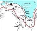
Braco map.jpg 1,436 × 1,193; 486 KB
-
Cockpit-Country.JPG 1,321 × 1,005; 720 KB
-
Cuba rel94.jpg 1,415 × 977; 220 KB
-
ECDM 20190919 TC LORENA.pdf 1,625 × 1,125; 783 KB
-
ECDM 20200730 TC ISAIAS.pdf 1,625 × 1,125; 739 KB
-
ECDM 20200824 TCs LAURA MARCO.pdf 1,625 × 1,125; 602 KB
-
ECDM 20200831 TC LAURA Overview.pdf 1,625 × 1,125; 542 KB
-
ECDM 20201007 TCs DELTA GAMMA.pdf 1,625 × 1,125; 641 KB
-
ECDM 20210706 TC ELSA update.pdf 1,625 × 1,125; 1.01 MB
-
ECDM 20240712 BERYL UCPM.pdf 1,625 × 1,125; 528 KB
-
ECDM 20240820 BERYL wrap-up.pdf 1,625 × 1,125; 501 KB
-
ECDM 20241107 TC RAFAEL.pdf 1,625 × 1,125; 457 KB
-
FLII Jamaica.png 1,541 × 715; 908 KB
-
Hopewell-SandyBay.jpg 2,517 × 830; 438 KB
-
Jamaica - DPLA - 5a63ae7e8cc1e5bd95ec3091db18144b.jpg 3,274 × 2,556; 915 KB
-
Jamaica Population Density, 2000 (5457621734).jpg 2,497 × 3,194; 538 KB
-
Jamaica Population Density, 2000 (6171911159).jpg 2,370 × 3,161; 539 KB
-
Jamaica slope map.png 1,601 × 729; 399 KB
-
Jamaica.png 1,082 × 659; 57 KB
-
JamaicanBoa3.svg 764 × 302; 231 KB
-
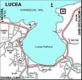
Lucea.JPG 1,145 × 1,116; 402 KB
-
Map of eastern jamaica (169055035).jpg 736 × 800; 155 KB
-
Map of Jamaica, showing churches of Scottish origin (imp-cswc-GB-237-CSWC47-LS11-002).jpg 4,855 × 4,870; 2.55 MB
-
May-Pen-map.jpg 606 × 442; 55 KB
-
Mobay-groß.JPG 1,506 × 1,370; 740 KB
-
Mobay-tourist.JPG 1,010 × 1,474; 682 KB
-
Montegobay.png 634 × 322; 15 KB
-
Oracabessa.JPG 1,359 × 1,831; 775 KB
-
PAT - Jamaica.gif 1,150 × 690; 125 KB
-
Population density of Jamaica parishes.png 2,104 × 1,615; 212 KB
-
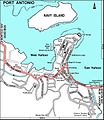
Port antonio in jamaica.PNG 673 × 342; 18 KB
-
PortAntonio-Umland.JPG 1,890 × 1,221; 642 KB
-
PortAntonio.JPG 1,420 × 1,634; 735 KB
-
Portantoniomap.png 673 × 344; 8 KB
-
PortRoyal.JPG 1,911 × 1,240; 652 KB
-
RunawayBay.JPG 2,074 × 1,080; 685 KB
-
Savanna-La-Mar.JPG 1,224 × 1,882; 650 KB
-
Yamaijia-ditu-zh.png 673 × 344; 63 KB


