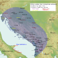
Category:Maps of Illyria
Jump to navigation
Jump to search
Wikimedia category | |||||
| Upload media | |||||
| Instance of | |||||
|---|---|---|---|---|---|
| Category combines topics | |||||
| Illyria | |||||
classical region in the western part of the Balkan Peninsula | |||||
| Instance of |
| ||||
| Named after |
| ||||
| Replaced by | |||||
| Different from | |||||
 | |||||
Subcategories
This category has the following 6 subcategories, out of 6 total.
Media in category "Maps of Illyria"
The following 175 files are in this category, out of 175 total.
-
1000BC Migrations Europe.png 1,475 × 1,200; 1.56 MB
-
200bc2ndMacedonianwar.png 572 × 471; 337 KB
-
218BCMAPMEDITERRANEAN (cropped).jpg 686 × 563; 38 KB
-
218BCMAPMEDITERRANEAN.jpg 1,216 × 720; 89 KB
-
240bcAntigonusIIGonatas.jpg 871 × 708; 236 KB
-
250bcAntigonusIIGonatas.jpg 871 × 708; 448 KB
-
3-bc map elznik.jpg 695 × 545; 203 KB
-
Adriatic Coast 201 BC 3rd century (English).svg 1,600 × 1,600; 8.65 MB
-
Adriatic Coast 201 BC 3rd century (Portuguese).svg 1,600 × 1,600; 8.64 MB
-
Adriatic Coast 210 BC 3rd century (English).svg 1,600 × 1,600; 8.65 MB
-
Adriatic Coast 210 BC 3rd century (Portuguese).svg 1,600 × 1,600; 8.65 MB
-
Adriatic Coast 220 BC 3rd century (English).svg 1,600 × 1,600; 8.66 MB
-
Adriatic Coast 220 BC 3rd century (Portuguese).svg 1,600 × 1,600; 8.66 MB
-
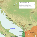
Adriatic Coast 226 BC 3rd century (English).svg 1,600 × 1,600; 8.66 MB
-
Adriatic Coast 228 BC 3rd century (English).svg 1,600 × 1,600; 8.7 MB
-
Adriatic Coast 230 BC 3rd century (English).svg 1,600 × 1,600; 8.68 MB
-
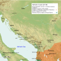
Adriatic Coast 237 BC 3rd century (English).svg 1,600 × 1,600; 8.64 MB
-
Adriatic Coast 240 BC 3rd century (English).svg 1,600 × 1,600; 8.65 MB
-
Approximate Extent of the Illyrian Territories (English).png 1,600 × 1,600; 4.54 MB
-
AtlBalk.a-660.jpg 318 × 327; 25 KB
-
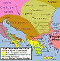
AtlBalk.b-530.jpg 318 × 327; 29 KB
-
AtlBalk.c-430.jpg 318 × 327; 164 KB
-
AtlBalk.d-330.jpg 318 × 327; 161 KB
-
AtlBalk.e-150.jpg 318 × 327; 168 KB
-
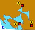
Bay of Kotor and fortresses (English).png 762 × 659; 858 KB
-
Bay of Kotor and fortresses.jpg 1,666 × 613; 125 KB
-
Bay of Kotor Illiryan fortresses.jpg 1,558 × 1,322; 87 KB
-
Central and Eastern Europe at the time of Augustus 6 AD.jpg 2,600 × 1,899; 740 KB
-
Dardania kingdom-sr.png 877 × 894; 48 KB
-
Dardania kingdom.png 877 × 894; 51 KB
-
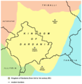
Dardania.png 615 × 278; 195 KB
-
Dardanian Kingdom (English).svg 837 × 582; 1.62 MB
-
Dardanian Kingdom (late 3rd century BC).png 3,190 × 3,086; 4.85 MB
-
Dardanian Kingdom (Portuguese).svg 837 × 582; 1.62 MB
-
Dardanian Kingdom under Bardyllis I (English).svg 837 × 582; 1.62 MB
-
Dardanian Kingdom under Bardyllis I (Portuguese).svg 837 × 582; 1.62 MB
-
Dardanian Kingdom under Bardyllis II (English).svg 837 × 582; 1.62 MB
-
Dardanian Kingdom under Bardyllis II (Portuguese).svg 837 × 582; 1.62 MB
-
Dardanian Kingdom under Bato (English).svg 837 × 582; 1.62 MB
-
Dardanian Kingdom under Bato (Portuguese).svg 837 × 582; 1.62 MB
-
Dardanian Kingdom under Cleitus (English).svg 837 × 582; 1.62 MB
-
Dardanian Kingdom under Cleitus (Portuguese).svg 837 × 582; 1.62 MB
-
Dardanian Kingdom under Longarus (English).svg 837 × 582; 1.62 MB
-
Dardanian Kingdom under Longarus (Portuguese).svg 837 × 582; 1.62 MB
-
Dardanian Kingdom under Monunius I (English).svg 837 × 582; 1.62 MB
-
Dardanian Kingdom under Monunius I (Portuguese).svg 837 × 582; 1.62 MB
-
Dardanian Kingdom under Monunius II (English).svg 837 × 582; 1.62 MB
-
Dardanian Kingdom under Monunius II (Portuguese).svg 837 × 582; 1.62 MB
-
Dardanian Kingdom under Mytilus (English).svg 837 × 582; 1.63 MB
-
Dardanian Kingdom under Mytilus (Portuguese).svg 837 × 582; 1.62 MB
-
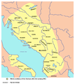
Die Illyrischen Stamme (German).png 643 × 800; 200 KB
-
Dionysius of Syracuse military expedition for Alcetas Map (English).png 994 × 793; 524 KB
-
Glasinac culture-sr.png 1,009 × 862; 59 KB
-
Glasinac culture.png 1,009 × 862; 66 KB
-
Grcka kolonizacija 550 st. ere.jpg 1,200 × 902; 191 KB
-
Great Illyrian Revolt (English).svg 1,600 × 1,367; 3.51 MB
-
Greek colonies 550 BC (English) (simple map).svg 1,200 × 902; 873 KB
-
Greek colonies 550 BC-hu.svg 1,200 × 902; 874 KB
-
GreekCitiesMapIllyriaAdriatic-es.png 1,557 × 1,118; 1.58 MB
-
GreekCitiesMapIllyriaAdriatic.png 1,557 × 1,118; 1.87 MB
-
Ilirija Ilirska Ilira plemena Mapa.png 2,161 × 2,160; 548 KB
-
Ilirska plemena-es.svg 1,857 × 1,503; 4.48 MB
-
Ilirska plemena.svg 1,981 × 1,603; 3.11 MB
-
Illyria and Dardania Kingdoms (228 BC) (English).svg 1,037 × 686; 2.1 MB
-
Illyrian colonies in Italy 550 BC (English) (simple map).svg 675 × 579; 259 KB
-
Illyrian colonies in Italy 550 BC (Portuguese) (simple map).svg 675 × 579; 255 KB
-
Illyrian colonies in Italy 550 BCE.jpg 675 × 579; 55 KB
-
Illyrian Tribes (Deutsch).svg 1,600 × 1,600; 8.57 MB
-
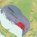
Illyrian Tribes (English).svg 1,600 × 1,600; 8.57 MB
-
Illyrian Tribes (Español).svg 1,600 × 1,600; 8.57 MB
-
Illyrian Tribes (Français).svg 1,600 × 1,600; 8.57 MB
-
Illyrian Tribes (Greek).svg 1,600 × 1,600; 8.57 MB
-
Illyrian Tribes (Italiano).svg 1,600 × 1,600; 8.57 MB
-
Illyrian Tribes (Portuguese).svg 1,600 × 1,600; 8.57 MB
-
Illyrian Tribes (Pусский).svg 1,600 × 1,600; 8.57 MB
-
Illyrian Tribes (Shqipe).svg 1,600 × 1,600; 8.57 MB
-
Illyrian Tribes (Български).svg 1,600 × 1,600; 8.57 MB
-
Illyrian Tribes (Македонски).svg 1,600 × 1,600; 8.57 MB
-
Illyrian Tribes (Српски-srpski).svg 1,600 × 1,600; 8.57 MB
-
Illyrian Tribes es.svg 2,873 × 2,493; 15.64 MB
-
Illyrian Tribes satellite Map (English).svg 947 × 791; 2.36 MB
-
Illyrian Tribes satellite Map (Greek).svg 947 × 791; 2.36 MB
-
Illyrian Tribes Visually impaired version (English).svg 652 × 432; 136 KB
-
Illyrian Tribes Visually impaired version (Portuguese).svg 652 × 432; 137 KB
-
Illyrian tribes-en.png 843 × 944; 71 KB
-
Illyrian tribes-sr.png 843 × 944; 73 KB
-
Illyrians (Deutsch).svg 1,600 × 1,600; 5.11 MB
-
Illyrians (English).svg 1,600 × 1,600; 5.11 MB
-
Illyrians (Español).svg 1,600 × 1,600; 5.11 MB
-
Illyrians (Français).svg 1,600 × 1,600; 5.11 MB
-
Illyrians (Greek).svg 1,600 × 1,600; 5.11 MB
-
Illyrians (Hungarian).svg 1,600 × 1,600; 5.11 MB
-
Illyrians (Italiano).svg 1,600 × 1,600; 5.11 MB
-
Illyrians (Portuguese).svg 1,600 × 1,600; 5.11 MB
-
Illyrians (Pусский).svg 1,600 × 1,600; 5.11 MB
-
Illyrians (Shqipe).svg 1,600 × 1,600; 5.11 MB
-
Illyrians (Български).svg 1,600 × 1,600; 5.11 MB
-
Illyrians (Македонски).svg 1,600 × 1,600; 5.11 MB
-
Illyrians (Српски-srpski).svg 1,600 × 1,600; 5.11 MB
-
Illyrians Ethnogenesis Theories (English).jpg 1,586 × 1,584; 2.57 MB
-
Illyrians proper.png 970 × 913; 893 KB
-
Illyrians.jpg 1,054 × 714; 1.27 MB
-
Illyrians.svg 993 × 794; 3.23 MB
-
IllyriansGR.jpg 800 × 542; 556 KB
-
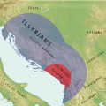
IllyrianTribes.jpg 2,000 × 2,000; 2.24 MB
-
IllyricumAD6RomanConditionofTribes.png 1,836 × 1,533; 2.56 MB
-
Illyrii Proprie Dicti aka Illyrians Proper aka Docleatae-pt.svg 716 × 507; 684 KB
-
Illyrii Proprie Dicti aka Illyrians Proper aka Docleatae.svg 716 × 507; 697 KB
-
Illyris Graeca from Orbis terrarum antiquus ca. 1861 (English).png 624 × 770; 74 KB
-
Illyris Graeca from Orbis terrarum antiquus ca. 1861.jpg 624 × 770; 546 KB
-
Kingdom of Illyria in 380 BC.png 1,078 × 1,148; 727 KB
-
Liburnia 1st AD.png 1,048 × 1,212; 1.32 MB
-
Liburnia 5th BC-SL.PNG 1,280 × 1,504; 1.1 MB
-
Liburnia 5th BC.PNG 1,212 × 1,504; 1.16 MB
-
Map of ancient Dardania and environs (English).svg 1,214 × 675; 378 KB
-
Map of ancient Dardania and environs (Portuguese).svg 1,214 × 675; 378 KB
-
Map of ancient Epirus and environs (Deutsch).svg 1,422 × 1,614; 1.76 MB
-
Map of ancient Epirus and environs (English) alternate contrast.svg 1,278 × 1,470; 6.06 MB
-
Map of ancient Epirus and environs (English).svg 1,303 × 1,500; 495 KB
-
Map of ancient Epirus and environs (Español).svg 1,303 × 1,500; 5.44 MB
-
Map of ancient Epirus and environs (Français).svg 1,303 × 1,500; 381 KB
-
Map of ancient Epirus and environs (Italiano).svg 1,303 × 1,500; 383 KB
-
Map of ancient Epirus and environs (Português).svg 1,303 × 1,500; 379 KB
-
Map of ancient Epirus and environs (Pусский).svg 1,303 × 1,500; 378 KB
-
Map of ancient Epirus and environs (Shqipe).svg 1,303 × 1,500; 380 KB
-
Map of ancient Epirus and environs (Български).svg 1,303 × 1,500; 378 KB
-
Map of ancient Epirus and environs (Македонски).svg 1,303 × 1,500; 378 KB
-
Map of ancient Epirus and environs (Српски-srpski).svg 1,303 × 1,500; 379 KB
-
Map of ancient Epirus and environs.png 474 × 556; 343 KB
-
Map of ancient Illyria by Oxford J. Vincent ca.1825 (English).png 966 × 1,343; 574 KB
-
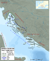
Map of Dalmatia (Illyria) focusing on a few tribes.png 650 × 476; 197 KB
-
Map of Illyris Deserta (English).png 882 × 577; 46 KB
-
Map of Pannonia and Illyria by Abraham Ortelius.jpeg 3,034 × 2,339; 2.18 MB
-
Map of Prehistoric Sites & Cultures Illyrian v1 (English).jpg 2,435 × 1,940; 764 KB
-
Map of Prehistoric Sites & Cultures Illyrian v2 (English).png 1,862 × 1,509; 2.64 MB
-
Map of the territory of Demetrius of Pharos (Portuguese).svg 1,600 × 1,600; 6.43 MB
-
Map of the Third Illyrian War 168 BC (hu).png 585 × 861; 732 KB
-
Mediterranean at 218 BC-de.png 2,858 × 1,696; 453 KB
-
Mediterranean at 218 BC-en.svg 2,058 × 1,221; 435 KB
-
Mediterranean at 218 BC-es.svg 2,058 × 1,221; 1.04 MB
-
Mediterranean at 218 BC-fr.svg 2,058 × 1,221; 457 KB
-
Mediterranean at 218 BC-he.svg 512 × 304; 368 KB
-
Mediterranean at 218 BC-mk.svg 2,058 × 1,221; 907 KB
-
Mediterranean at 218 BC-pt.svg 2,058 × 1,221; 659 KB
-
Mediterranean at 218 BC-zh.svg 2,572 × 1,526; 493 KB
-
Meteon Labeatidis terrae.svg 319 × 209; 51 KB
-
Popolazioni della Dalmazia.png 878 × 707; 304 KB
-
Prehistoric Illyrians Sites & Cultures by Wilkes.png 1,030 × 892; 147 KB
-
Proto-Illyrian & Illyrian Precursors Ethnogenesis Map (English).svg 947 × 791; 2.33 MB
-
Proto-Illyrian & Illyrian Precursors Ethnogenesis Map (Portuguese).svg 947 × 791; 2.32 MB
-
Rivolta pannonica 6 jpg.JPG 1,127 × 777; 241 KB
-
Rivolta pannonica 7.jpg 1,127 × 777; 242 KB
-
Rivolta pannonica 8.jpg 1,127 × 777; 239 KB
-
Rivolta pannonica 9.jpg 1,127 × 777; 244 KB
-
Roman Illyricum by Wilkes (English).png 600 × 690; 120 KB
-
Roman Illyricum in 40 BC.png 2,724 × 2,204; 5.05 MB
-
Roman period tribes in Illyria and Lower Pannonia.png 1,859 × 1,507; 3.08 MB
-
Roman war in Illyricum 34 BC.png 2,724 × 2,204; 5.05 MB
-
Roman war in Illyricum 35 BC.png 2,724 × 2,204; 5.08 MB
-
Romanized and Hellenized Illyria & Dalmatia (English).svg 1,382 × 1,424; 6.05 MB
-
Romanized and Hellenized Illyria & Dalmatia (Portuguese).svg 1,382 × 1,424; 6.04 MB
-
Romanized and Hellenized Illyria & Dalmatia.jpg 550 × 600; 223 KB
-
South Illyria & Environs (English).svg 672 × 654; 694 KB
-
South Illyria & Environs (Portuguese).svg 672 × 654; 694 KB
-
South Illyria and Environs (English).png 782 × 1,030; 196 KB
-
THRACIA et ILLYRICUM 1913 by Julian A. Kulakovskij.jpg 4,329 × 2,553; 2.58 MB
-
Thracia Macedonia & Illyris Graeca from Orbis terrarum antiquus ca. 1861.jpg 3,090 × 2,472; 7 MB
-
Tribes in Illyria (English).svg 1,600 × 1,600; 5.17 MB
-
Tribes in Illyria (Greek).svg 1,600 × 1,600; 5.18 MB
-
Tribes in Illyria (Portuguese).svg 1,600 × 1,600; 5.17 MB
-
Tribes in Illyria (Pусский).svg 1,600 × 1,600; 5.18 MB
Categories:
- Illyria
- Maps of the history of the ancient Balkans
- Maps of the history of Albania in ancient times
- Maps of the history of Kosovo in ancient times
- Maps of the history of Montenegro in ancient times
- Maps of the history of Serbia in ancient times
- Maps of the history of Vojvodina
- Maps of the history of Bosnia and Herzegovina in ancient times
- Maps of the history of Croatia in ancient times
- Maps of the history of Slovenia in ancient times
- Maps of ancient Greece
- Maps of the history of Dalmatia


