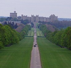
Category:Berkshire
Jump to navigation
Jump to search
ceremonial but non-administrative county of England | |||||
| Upload media | |||||
| Instance of | |||||
|---|---|---|---|---|---|
| Named after | |||||
| Location |
| ||||
| Capital | |||||
| Population |
| ||||
| Area |
| ||||
| Different from | |||||
| Said to be the same as | Berkshire (historic county of England, ceremonial county of England, 1844) | ||||
 | |||||
Deutsch: Berkshire ist eine Grafschaft im Süden Englands.
English: Berkshire is a county in southern England.
Français : Berkshire est une comté du sud de l'Angleterre.
Nederlands: Berkshire is een graafschap in Engeland.
Norsk bokmål: Berkshire er et grevskap i det sørlige England.
Subcategories
This category has the following 42 subcategories, out of 42 total.
Media in category "Berkshire"
The following 61 files are in this category, out of 61 total.
-
A Pond In The Berkshires In The Spring (218237505).jpeg 2,048 × 1,152; 734 KB
-
Access to Racecourse marina (24566050523).jpg 3,648 × 2,432; 1.63 MB
-
Baxter Healthcare - geograph.org.uk - 1154113.jpg 640 × 427; 219 KB
-
Berkshire - Heathrow Scenery (geograph 5257336).jpg 6,000 × 4,000; 7.53 MB
-
Beyou-logo.jpg 153 × 47; 13 KB
-
Bricked up door - geograph.org.uk - 1711748.jpg 1,024 × 683; 160 KB
-
CJ Rolfe ^ Son - panoramio.jpg 1,952 × 3,264; 1.63 MB
-
Cobbled pathway (5214049577).jpg 4,349 × 2,693; 6.61 MB
-
County Flag of Berkshire (commercial version).svg 552 × 333; 66 KB
-
Elementary jumps - geograph.org.uk - 597497.jpg 640 × 477; 88 KB
-
En-Berkshire.ogg 0.7 s; 14 KB
-
Farmland on Roden Downs - geograph.org.uk - 3635508.jpg 640 × 419; 116 KB
-
Fawley War Memorial - geograph.org.uk - 1746862.jpg 1,734 × 2,428; 1.54 MB
-
Forbury Road by night (94220402).jpg 1,280 × 1,024; 499 KB
-
Goring Gap (5815211932).jpg 1,600 × 1,067; 212 KB
-
Goring Panorama Banner.jpg 8,400 × 1,200; 11.4 MB
-
Gun steadies in the floor - geograph.org.uk - 1714696.jpg 1,024 × 768; 187 KB
-
Hangman's Stone Leckhampstead Berks. - geograph.org.uk - 946309.jpg 640 × 483; 183 KB
-
Houses in Bridgewater, Connecticut.jpg 5,184 × 3,456; 6.19 MB
-
Illegible - panoramio.jpg 1,952 × 3,264; 1.31 MB
-
Kennet Canal Lock Gate (42738672740).jpg 14,840 × 6,000; 60.5 MB
-
M4 crossing the B4494 north of Newbury - geograph.org.uk - 1250050.jpg 640 × 480; 100 KB
-
Man carrying kayak while woman tries to take photo (4849444376).jpg 2,465 × 2,068; 4.13 MB
-
Map showing the traditional, geographical county of Berkshire, England.png 4,967 × 4,967; 4.35 MB
-
Marsh Common Sign, Weston, Berkshire.jpg 1,536 × 2,048; 1.59 MB
-
Misty wharf (6364238203).jpg 3,870 × 2,118; 4.19 MB
-
New building near Penclose Cottage - geograph.org.uk - 596332.jpg 640 × 477; 96 KB
-
Nice (2105540002).jpg 640 × 480; 117 KB
-
North-western exit to Greenham Common - geograph.org.uk - 1187334.jpg 425 × 640; 188 KB
-
Number on the wall - geograph.org.uk - 1713229.jpg 533 × 800; 93 KB
-
Oakley Court (24562254754).jpg 2,000 × 3,000; 1.55 MB
-
Pangbourne Sun 007.jpg 3,072 × 2,304; 868 KB
-
Pole (4696093249).jpg 3,415 × 2,331; 2.77 MB
-
Ripples (4395280067).jpg 2,592 × 2,053; 3.36 MB
-
Ripples Cropped (4398304361).jpg 867 × 1,413; 728 KB
-
River Lambourn at Easton (1) - geograph.org.uk - 1659061.jpg 640 × 480; 134 KB
-
Ryeish Green, Berkshire - geograph-2254732.jpg 1,800 × 1,200; 951 KB
-
Salt Box - geograph.org.uk - 1718704.jpg 1,600 × 1,153; 364 KB
-
Seagull (6453269891).jpg 4,746 × 2,610; 9.19 MB
-
Stables - geograph.org.uk - 8733.jpg 640 × 346; 249 KB
-
Stick reflection (4372349513).jpg 2,806 × 2,076; 2.94 MB
-
Swanlake.jpg 4,608 × 3,456; 4.52 MB
-
Thames Valley UK PCC election 2024.svg 597 × 673; 651 KB
-
Tittenhurst - geograph.org.uk - 707.jpg 640 × 427; 46 KB
-
Two of the points - geograph.org.uk - 1736288.jpg 1,024 × 683; 105 KB
-
Umpachene Falls, May 2014.jpg 1,200 × 797; 758 KB
-
Vapour trails, Ashampstead - geograph.org.uk - 678154.jpg 640 × 480; 68 KB
-
Vending machine (94220894).jpg 1,280 × 1,024; 328 KB
-
View from the B4494 - geograph.org.uk - 854374.jpg 640 × 427; 78 KB
-
Weir at Padworth Mill - geograph.org.uk - 1189273.jpg 640 × 427; 191 KB
-
West Mills Swing Bridge - panoramio.jpg 1,600 × 1,200; 689 KB
-
Windsor marina (25166554036).jpg 3,648 × 2,048; 1.65 MB
-
Eastbury Down - geograph.org.uk - 228694.jpg 640 × 480; 152 KB
-
Entrance to Training Centre, Sulhamstead - geograph.org.uk - 22978.jpg 640 × 480; 455 KB
-
Gallops on the Ridgeway. - geograph.org.uk - 67226.jpg 640 × 480; 111 KB
-
Manor Farm B and B - geograph.org.uk - 20823.jpg 640 × 480; 289 KB
-
The Old Workhouse - geograph.org.uk - 89659.jpg 597 × 370; 53 KB


